

Welcome to the Estonian University of Life Sciences Lake Page webpage. On this page we give an overview and present the continuous automated monitoring carried out by us on the Estonian lakes.
Estonian lakes equipped with automated buoy systems are site members of the Global Lake Ecological Observatory Network (GLEON). GLEON is a world-wide grassroots network of people, institutions, programs, and data dedicated to understanding, predicting, and communicating the impact of natural and anthropogenic influences on lakes.
Attention! Raw data. The data are provided as these are automatically received from the sensors without quality control, warranty or condition of any nature. EMU does not warrant the quality, accuracy, or completeness of any information, data or product from these web pages.
If you want to use the data from this website or need a wider access to the data, please contact Alo.Laas@emu.ee
Lake Võrtsjärv automatic weather station was established in late 2009 on the pier of the Centre for Limnology (N 58.211151, E 26.108136). The original station contaied Vaisala Weather Transmitter WXT520 and Star Pyranometer 8101. and the data collection was controlled with a Gealog SG Alphanumeric datalogger.
At the end of 2018 the station was renovated. Current measurements are done by Airmar 200WX weather station and Star Pyranometer 8101 and the data collection is controlled by the Flydog Marine datalogger. Parameters collected at 5-minutes intervals include: air temperature, air pressure, humidity, wind speed and direction, and solar irradiance.
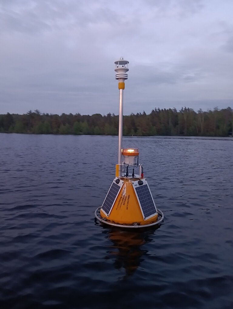
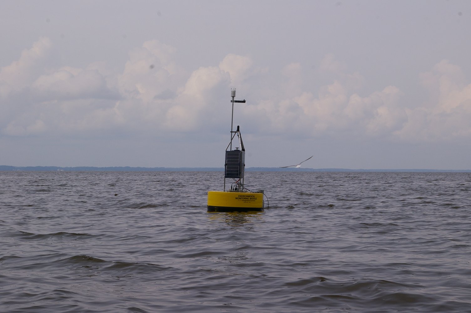
Lake Võrtsjärv Buoy was deployed in the summer of 2010 near the deepest point of the lake (N 58.211798, E 26.103163) to gather high resolution data of lake water quality and surrounded air. According to the EU Water Framework Directive, Lake Võrtsjärv represents its own type in case Estonian lake types, Võrtsjärv (type VI) - water area between 100-300 km2, water with medium hardness, poor in chlorides, non-stratified, light-coloured lake.
YSI EMM 700 bay buoy has been used for a float. YSI 6600 V2-4 multisonde was fixed at 1 meter depth for underwater measurements at the first years. Data collection was controlled with Campbell CR1000 datalogger.
System was renewed in 2021. Current underwater measurements are collected with EXO2 multisond and data collection is controlled by Flydog Marine datalogger.
For weather parameters buoy is equipped with a Vaisala Weather Transmitter WXT520 and a Li-Cor pyranometer (LI-200).
Collected parameters include: water temperature, dissolved oxygen saturation, chlorophyll fluorescence, phycocyanin fluorescence, pH, conductivity, turbidity, air temperature, air pressure, humidity, precipitation, wind speed and direction, and solar radiation. All parameters are collected at 10 minutes interval.
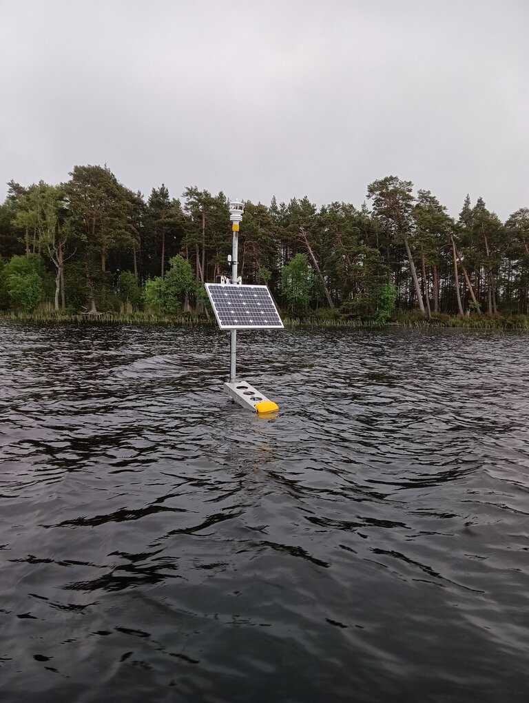
Lake Saadjärv profiling buoy was established in summer 2015 (N58.53758°N, 26.64719°E) to gather high resolution data on meteorology and water quality of the lake. According to the EU Water Framework Directive, Lake Saadjärv represents Estonian lake type III - Surface less than 10 km2, water with medium hardness, poor in chlorides, stratified lakes.
Flydog Marine coastal profiler „Oscar“ collects underwater data with EXO2 multisonde form 2 to 20 meters depths. Collected parameters include: water temperature, dissolved oxygen saturation, chlorophyll fluorescence, phycocyanin fluorescence, pH, conductivity, turbidity and fDOM data. All parameters are collected at 30 minutes interval.
Lake Saadjärv profiling buoy is also equipped with an Airmar 200WX weather station and a Li-Cor quantum sensor (LI-190SZ) for weather parameters. Measurements for air temperature, air pressure, humidity, wind speed and direction, and PAR are collected at 1 minute interval.
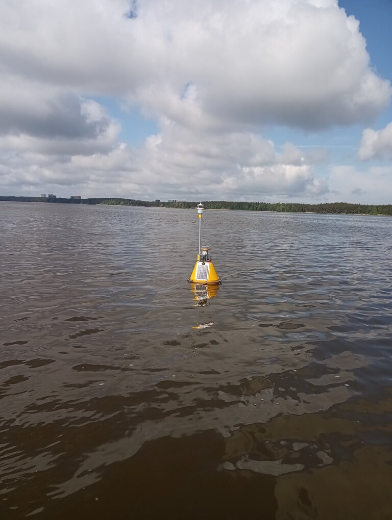
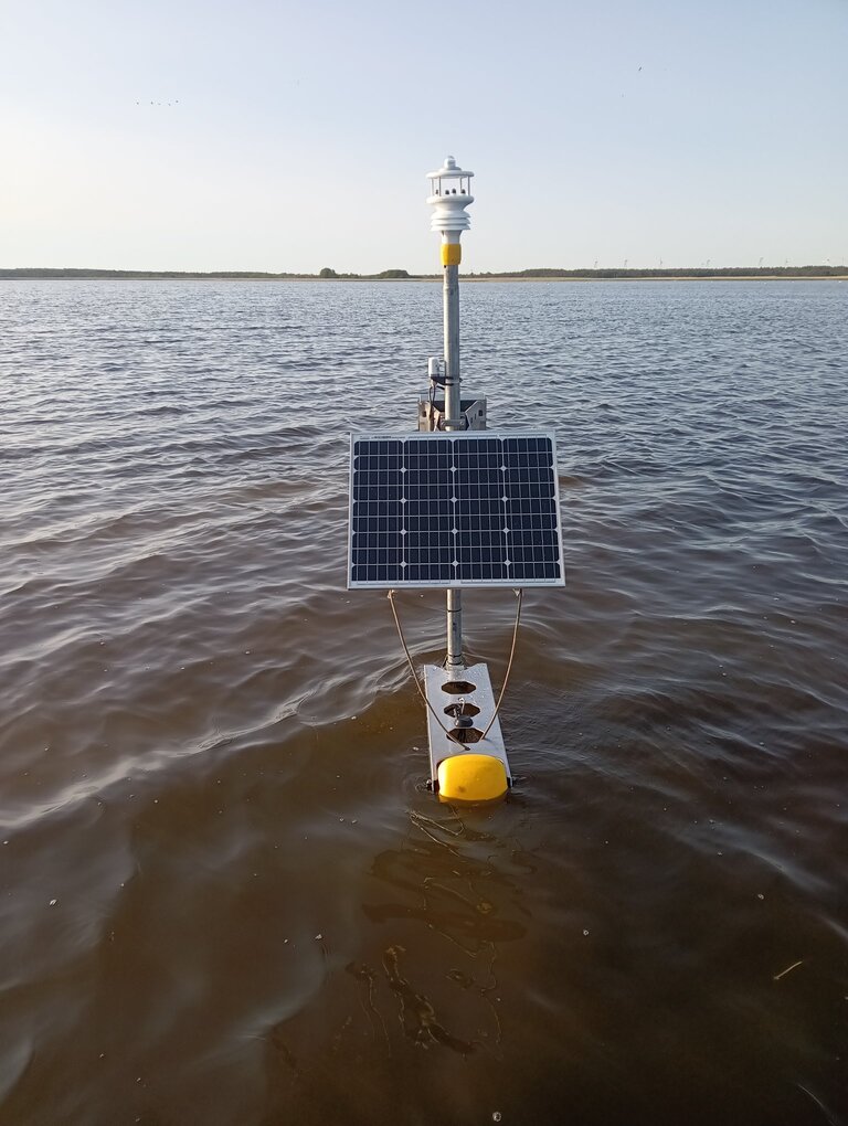
Lake Ülemiste buoy station was installed on the water body in May 2025 (59°23'57.0"N 24°46'08.0"E). The automated station is used on the lake during the open-water period (ice-free time). According to the EU Water Framework Directive, Lake Ülemiste represents Estonian lake type III - Surface less than 10 km2, water with medium hardness, poor in chlorides, non-stratified lakes.
The buoy station is equipped with a Flydog Marine data logger. For in-water measurements, an EXO2s multiparametric probe is used in 1 meter depth. Weather data are collected at around 1.6 meters above the water using the GILL MaxiMet GMX501 multi-parameter Compact Weather Station.
Water temperature, pH, specific conductance, water turbidity, dissolved oxygen saturation, chlorophyll and phycocyanin fluorescence and dissolved organic matter fluorescence is collected in 10 minutes frequency. Air temperature, air pressure, humidity, wind direction and speed, as well as global irradiance is measured in 1 minute frequency.
Lake Äntu Sinijärv buoy station was installed on the water body in May 2025 (59°03'50.6"N 26°14'26.8"E). The automated station is used on the lake during the open-water period (ice-free time). According to the EU Water Framework Directive, Lake Äntu Sinijärv represents Estonian lake type I - Surface less than 10 km2, very hard water, poor in chlorides, non-stratified lakes.
The buoy station is equipped with a Flydog Marine data logger. For in-water measurements, an EXO2s multiparametric probe is used in 1 meter depth. Weather data are collected at around 1.6 meters above the lake surface using the GILL MaxiMet GMX501 multi-parameter Compact Weather Station.
Water temperature, pH, specific conductance, water turbidity, dissolved oxygen saturation, chlorophyll and phycocyanin fluorescence and dissolved organic matter fluorescence are collected in 10 minutes frequency. Air temperature, air pressure, humidity, wind direction and speed, as well as global irradiance is measured in 1 minute frequency.
Lake Nigula buoy station was installed on the water body in May 2025 (58°00'28.0"N 24°42'28.2"E). The automated station is used on the lake during the open-water period (ice-free time). According to the EU Water Framework Directive, Lake Nigula represents Estonian lake type IV - Surface less than 10 km2, sort water, poor in chlorides, non-stratified, dark-coloured lakes.
The buoy station is equipped with a Flydog Marine data logger. For in-water measurements, an EXO2s multiparametric probe is used in 1 meter depth. Weather data is collected at around 1.6 meters above the lake surface using the GILL MaxiMet GMX501 multi-parameter Compact Weather Station.
Water temperature, pH, specific conductance, water turbidity, dissolved oxygen saturation, chlorophyll and phycocyanin fluorescence and dissolved organic matter fluorescence are collected in 10 minutes frequency. Air temperature, air pressure, humidity, wind direction and speed, as well as global irradiance is measured in 1 minute frequency.
Automated station was installed into Lake Sutlepa meri in June 2025 (59°02'16.1"N 23°33'40.0"E). The automated station is used on the lake during the open-water period (ice-free time). According to the EU Water Framework Directive, Sutlepa meri represents Estonian lake type VIII, Lagoons - Chloride-rich lakes with a distance of ≤5 km from the sea.
Automated station is equipped with a Flydog Marine data logger. For in-water measurements, an EXO2s multiparametric probe is used in 0.5 meter depth. Weather data are collected at around 1.6 meters above the lake surface using the GILL MaxiMet GMX501 multi-parameter Compact Weather Station.
Water temperature, pH, specific conductance, water turbidity, dissolved oxygen saturation, chlorophyll and phycocyanin fluorescence and dissolved organic matter fluorescence are collected in 10 minutes frequency. Air temperature, air pressure, humidity, wind direction and speed, as well as global irradiance is measured in 1 minute frequency.
Automated station was installed into Tänavjärv in June 2025 (59°10'56.7"N 23°49'32.3"E). The automated station is used on the lake during the open-water period (ice-free time). According to the EU Water Framework Directive, Lake Tänavjärv represents Estonian lake type V - Surface less than 10 km2, soft water, poor in chlorides, non-stratified, light-coloured lakes.
Automated station is equipped with a Flydog Marine data logger. For in-water measurements, an EXO2s multiparametric probe is used in 0.5 meter depth. Weather data is collected at around 1.6 meters above the lake surface using the GILL MaxiMet GMX501 multi-parameter Compact Weather Station.
Water temperature, pH, specific conductance, water turbidity, dissolved oxygen saturation, chlorophyll and phycocyanin fluorescence and dissolved organic matter fluorescence are collected in 10 minutes frequency. Air temperature, air pressure, humidity, wind direction and speed, as well as global irradiance is measured in 1 minute frequency.
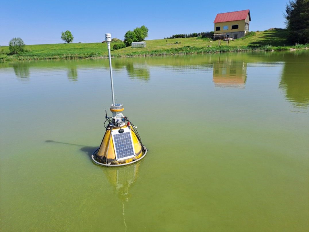
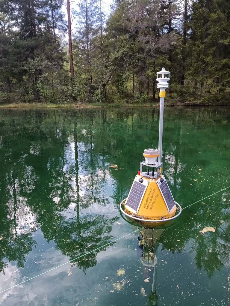
Lake Põrmujärv buoy station was installed on the water body in May 2024 (N57.877630, E 26.961661). The automatic station is used on the lake during the open-water period (ice-free time).
For in-water measurements, sensors from the French company AQUALABO (earlier Ponsel) are mounted on the buoy. At a depth of 0.5 meters water pH, temperature, dissolved oxygen and turbidity is recorded; at a depth of 1.5 meters, changes in water temperature and dissolved oxygen are collected over time. The sensors measure every 30 minutes. On the website you can see the measurements of the selected parameters at different depths.
Lake Põrmujärv buoy is also equipped with an Airmar 200WX multiweather station for weather parameters. Measurements for air temperature, air pressure, humidity, wind speed and direction are collected at every 2 minutes intervals.
The automated environmental data collection in Lake Põrmujärv is funded by the Estonian-Latvian Interreg project BioFloat. The aim of the project is to improve biodiversity and the health of aquatic ecosystems in the urban environment. This will be done by carefully developing and testing three new green infrastructure elements, as well as by actively involving target groups in Latvia and Estonia. More detailed information about the BioFloat project can be found here - BioFloat - Floating islands as biodiversity pit stops and pollution cutouts towards more resilient cities (BioFloat) - LHEI


The collection of the automated continuous monitoring data provided on this website is supported by the European Union LIFE programme project " Enabling collaborative efforts for systemic change in Estonian River Basin Management" (101147477 - LIFE23-IPE-EE-LIFE SIP WET-EST); by the European Union Interreg Estonia-Latvia programme project "Floating islands as biodiversity pit stops and pollution cut outs towards more resilient cities - BioFloat" and by the Estonian University of Life Sciences (EMU)
The research infrastructure has been co-funded by the Estonian Research Council's project "Eesti Keskkonnaobservatoorium" (TARISTU24-TK11).